Landscape
A Glimpse of the World that was

Topic Images
- Click on for a map showing where the photograph was taken
- Click on for details about the image
There are currently 23 photographs in this section.
Past escarpment
It was easy to forget how dramatic the terrain could be

The view south from Thelma Head, Royal National Park NSW [Jul-2019 401KB]
Unlimited potential
Entire hillsides were covered with these things, just standing there and not doing anything

The lower portion of the Wodi Wodi track, near Coalcliff NSW [Oct-2020 827KB]
Public Private Partnerships
Local governments were prepared to go to any length to protect the value and amenity of beach–side mansions (The Guardian, 2021)

Collaroy Beach anti-erosion seawall. Revisited the site in Mar 2024 and by then sand had been piled almost to the top of the wall [Apr-2022 484KB]
Across the rill and into the trees
The way out was much easier than Papa feared

Fern Dell, near Springwood NSW [Oct-2019 707KB]
The way out was not easy
The unprecedented was discreetly normalised

Florabella pass track, Blue Mountains National Park [Nov-2019 716KB]
Retro refurb
Tranquilly through adverse possession

Whitely Gardens on reclaimed NSW Railway land, Lavender bay in Sydney [Oct-2020 736KB]
Peak oil
Rapid obsolescence was just around the corner

Motorcycle parking at the top of Hill Street, North Sydney [Oct-2020 378KB]
Remarks
Precipitous descent
Decades of wandering through a hostile terrain, only to flounder in the sea

Ocean cliffs south of Little Marley, Royal National Park NSW [Aug-2020 458KB]
Remarks
Rewilding the wilderness
Civilisation was only a few kilometres away, although you would never know it

Magdala creek, Blue Mountains National Park [Oct-2019 688KB]
Go tell the Spartans
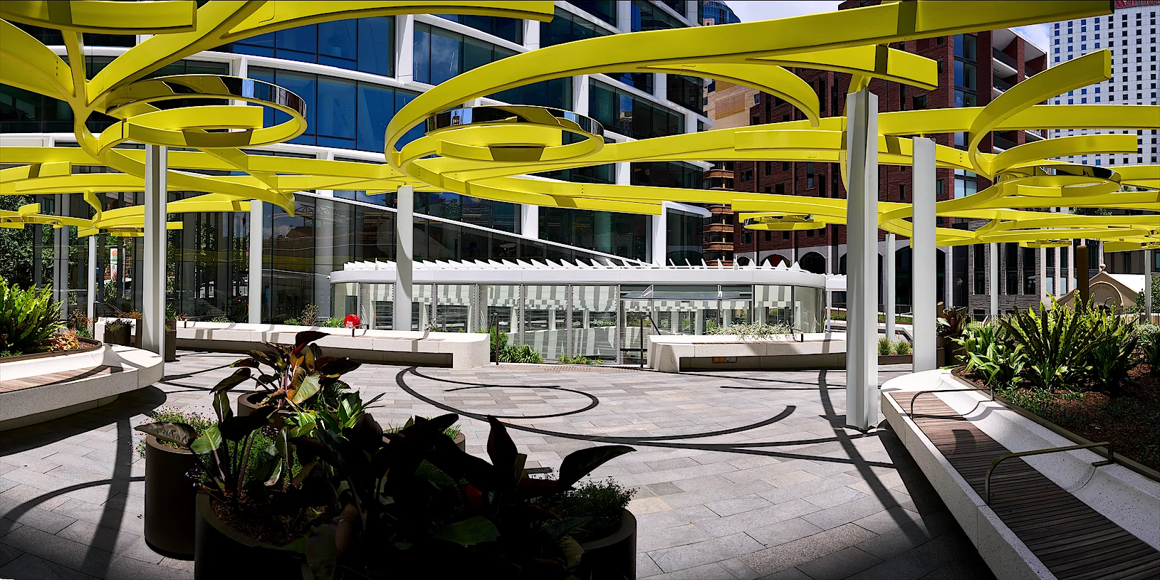
Philip Oldfield, who reviewed Quay Quarter Tower for Architecture Australia, argued that the building is one of the most important of the 21st century, as a demonstration of how office towers of more than 100 metres could be adapted instead of demolished and replaced

Quay Quarter Tower courtyard, Circular Quay [Dec-2022 364KB]
Pac–Man rock
Eventually the environment will reward us for our diligence

Florabella pass track, Blue Mountains National Park [Aug-2021 727KB]
Tracks through the past
COVID lockdowns encouraged the rediscovery of our neighbourhoods

Tramway track at Darks Common, Lapstone [Aug-2021 794KB]
Home before the leaves fall
The mist was smoke and haze, the leaves fallen due to drought and fire

Woodford bushfire aftermath, Blue Mountains [Dec-2019 706KB]
Beneath the steps
The smallest details were often overlooked

Sassafras Gully Track, near Springwood [Aug-2021 625KB]
A crown of ashes
Every Christmas we would gaze up at the pyrocumulus sky, exchange Bushfire Survival Plans and kiss anxiously beneath the epicormic shoots

Woodford bushfire aftermath, Blue Mountains [Dec-2019 705KB]
Remarks
Zigzag environments
Our infrastructure was forever being torched or overgrown

Zigzag Railway upper and lower viaducts, Clarence [Jul-2019 640KB]
Features of heritage redevelopment
Mate, if you want to make an omelette then you gotta break a few eggs

1920s heritage shops at Lawson in the Blue Mountains NSW, prior to demolition in Dec 2010.
This linear panorama — divided into three strips for easier viewing — was composited by hand from 62 source images. The master image is a continuous panorama 52000 × 3300 pixels [Oct-2006 304KB]
Abrupt about face
The first explorers got a nasty surprise when they tried to follow the rivers inland

Glenbrook Creek boulders, Lapstone [Aug-2021 520KB]
Temporary respite
Spend all morning crawling over room–sized boulders, before having a break and doing it all over again on the way back

Glenbrook Gorge, Lapstone [Aug-2021 611KB]
Remarks
Wolo world
Most of the snow melted in the middle of January. Luckily there was huge dump at the beginning of March

Zermatt township & Matterhorn CH [Feb-2024 484KB]
Cruise to live
We were truly global citizens who liked to travel whenever the fancy grabbed us

Majestic Princess cruise–ship at the Sydney Overseas Passenger Terminal [Dec-2022 372KB]
Leave No Trace
There will come a time when it will be hard to believe we were ever here

Fern Dell, Springwood Blue Mountains National Park [Oct-2019 773KB]
Golden mean
The rise and fall of the west glowed with unfulfilled promise

Garawarra Ridge, Royal National Park NSW [Oct-2019 601KB]
Notes
These images are multi-shot panoramas, typically showing a view 120° wide and 38° vertical
They were assembled from 6−10 rectilinear images, shot in portrait-format and using an entrance-pupil aligned camera mount. The individual shots were then “stitched” to create partial-panoramas @ 110 MPixel in size